Thursday, January 4, 2024

Proposed US States that don't exist

It is generally known that the United States of America started with 13 states and is now is composed of 50 different states. However, what is not widely known is that there were many proposals for new U.S. states that never came to fruition. Lack of popular support or the refusal of relevant government authorities to grant statehood contributed to the downfall of most of these proposals. 

Here are a few of the proposals below:

Franklin

The period following the Revolutionary War was marked by a few shady land deals made as the America we know today took shape. One of those almost led to the founding of a state called Franklin in what is now eastern Tennessee. On August 23, 1784, the State of Franklin declared its independence from North Carolina. The independence would prove to be short-lived. 

Further Details >


Deseret

A giant state proposed by the Church Of Latter Day Saints in 1849, Deseret would have contained parts of present day Utah, Arizona, California, Idaho, Nevada, New Mexico, Oregon and Wyoming. The provisional state existed for slightly over two years, but was never recognized by the United States government. The name derives from the word for "honeybee" in the Book of Mormon. The creation of Utah Territory in 1850 put an end to dreams of Deseret.

Further Details >


Superior

The state of Michigan was admitted to the Union in 1837, incorporating both the Upper and Lower Peninsulas. The Lower Peninsula developed an economy based on agriculture and manufacturing, while the Upper Peninsula's became based on forestry and mining. Travel between the two peninsulas remained difficult (especially in winter), and the people of the Upper Peninsula developed a distinct cultural identity as "Yoopers" (derived from "U.P.-ers"). Later, as the mining industry declined, Yoopers came to feel that their concerns were ignored by the state government, which was dominated by the populous cities of southern Lower Michigan.

Efforts for the Upper Peninsula to secede and form a new state date to 1858, when a convention was held for the purpose of combining the Upper Peninsula, northern Wisconsin, and northeast Minnesota into a new state to be called Superior,
  • In 1897, another proposal for creating a state of Superior included areas in the Upper Peninsula along with portions of Wisconsin.
  • In 1959, following the statehood of Alaska and Hawaii, Ironwood, Michigan resident Ted Albert sued for "divorce" between the two peninsulas.
  • In 1962, an Upper Peninsula Independence Association was founded to advocate for the formation of a state of Superior. A secession bill was submitted to the Michigan Legislature, and 20,000 petition signatures were collected -- 36,000 short of the number needed for a ballot referendum on separation.
  • Efforts continued into the mid-1970s and some support for statehood still exists in the region, although no organized movement was active as of 2012.

State of Lincoln

The State of Lincoln was proposed to consist of the Panhandle of Idaho and Eastern Washington (that is, east of the Cascade Mountains). It was first proposed by Idaho in 1865, when the capital was moved from Lewiston in December 1864 to its present-day location of Boise in January 1865.

Further Details >


Sequoyah

One of the most unique states that almost came to be was the State of Sequoyah. The State of Sequoyah, proposed to Congress in 1905, was to have been created out of the Oklahoma Territory as a State with a strong Native American majority. Covering a territory that corresponds roughly to the eastern half of today’s State of Oklahoma, the would-be state included land that had been allotted to Native Americans through a variety of treaties following the passage of the Indian Removal Act of 1830. 

The State of Sequoyah was a proposed state to be established from the Indian Territory in the eastern part of present-day Oklahoma. In 1905, with the end of tribal governments looming (as prescribed by the Curtis Act of 1898)-- Native Americans of the Five Civilized Tribes—the Cherokee, Choctaw, Chickasaw, Creek (Muscogee), and Seminole—in Indian Territory proposed to create a state as a means to retain control of their lands. Their intention was to have a state under Native American constitution and governance. The proposed state was to be named in honor of Sequoyah, the Cherokee who created a writing system in 1825 for the Cherokee language.

President Theodore Roosevelt then proposed a compromise that would join Indian Territory with Oklahoma Territory to form a single state and resulted in passage of the Oklahoma Enabling Act, which he signed June 16, 1906.[5][6] Oklahoma became the 46th state on November 16, 1907

Further Details >

Texlahoma

In 1935, in response to what proponents felt was lack of state attention to road infrastructure, A proposal was put forth that 46 northern Texas counties and 23 western Oklahoma counties secede to form a new, roughly rectangular state called Texlahoma.

Absaroka

Absaroka  was a proposed state in the United States that would have comprised parts of the states of Montana, South Dakota, and Wyoming, which contemplated secession in 1939.

Further Details >


Jefferson

Unsurprisingly, there have been a quite few attempts to create a state named after Thomas Jefferson. This one encompassed counties in Oregon and California, which tried to break away in 1941. They made headlines when armed men stopped traffic on Route 99 to hand out their flyers, but the proposal lost all of its momentum a couple months later, when the attack on Pearl Harbor saw America enter the war.

Further Details >


Forgottonia

Smack in the middle of the country could have been a state called Forgottonia. Comprising geographic region that forms the distinctive western bulge of Illinois and consists of 14 counties. Forgottonia was an idea created by a group of disgruntled citizens who felt, well, forgotten. In the early 1970s, the would-be state's residents proposed an interstate that would run from Chicago to Kansas City, but they were rebuffed and so decided to try to split off.


Yes - even Long Island!

From 2007 to 2009, Long Island residents discussed secession on the grounds that their tax money is not used to fund programs in their counties. Proposals were made for the entire island (Kings, Queens, Nassau, and Suffolk counties) and for just the two suburban counties (Nassau and Suffolk).

Further Details >


Thursday, January 12, 2023

The Changing Shoreline of New York City

I am sure most folks know that Manhattan has been expanded outward over the years but did you know that the west side was purposely re-dug and contracted to accommodate the berthing of huge ocean liners?

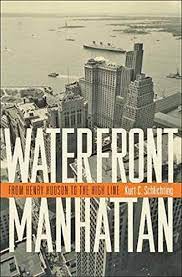
I just finished this interesting book and learned a lot!
Waterfront Manhattan: From Henry Hudson to the High Line

Yep - There once was a 13th Avenue!

In the early 20th century, New York wanted to build longer piers along the Hudson to accommodate bigger ships such as the RMS Lusitania and the RMS Titanic. However, the United States government, which controls the bulkhead line, refused to allow longer piers to be built. The shipping companies were reluctant to build longer piers further uptown because existing infrastructure such as the tracks of the New York Central Railroad and the 23rd Street ferry station were already in place downtown. To solve this problem, the city took the unusual step of removing the section of landfill on which Thirteenth Avenue ran south of 22nd Street so the Chelsea Piers could be constructed to handle the liners.

Diagram of the relocation of the west side shoreline to accommodate ocean liners:
(from the book)

The Chelsea Piers

The huge Chelsea Piers were built and opened in 1910 for the ocean liners
"For the next 50 years, the Chelsea Piers served the needs of the New York port: first, as the city's premier passenger ship terminal; then as an embarkation point for soldiers departing for the battlefields of World Wars I and II; and finally, during the late 1950s and early 1960s, as a cargo terminal.

After that, the Chelsea Piers, like much of Manhattan's waterfront, became neglected maritime relics, made obsolete by the jet plane that whisked passengers across the Atlantic and the large container ships that required dock facilities and truck linkages that Manhattan could never provide.

Chelsea Piers were designed by the architectural firm of Warren and Wetmore, which was also designing Grand Central Terminal at the same time. The Chelsea Piers replaced a hodgepodge of run-down waterfront structures with a magnificent row of grand buildings embellished with pink granite facades." Source
Sadly after World War II, long-distance aircraft became the main form of travel between continents and ocean liners became obsolete. Advances in automobile and railway technology also played a role. As a result,  the huge piers that lined the West side deteriorated.

West Side Elevated Highway 

As the automobile and trucks emerged as the dominant means of local transportation across America one solution for the crumbing ruins festering on the West side was to build a highway.

The West Side Elevated Highway was an elevated section of New York State Route 9A (NY 9A) running along the Hudson River in the New York City borough of Manhattan to the tip of the island. It was an elevated highway, one of the first urban freeways in the world.

Built between 1929 and 1951, the highway had narrow confines—which could not accommodate trucks—and sharp S exit ramps that made it obsolete almost immediately. Maintenance was minimal, and the use of corrosive salts to de-ice the highway in winter accelerated its decay. When chunks of its facade began to fall off due to lack of maintenance, and a truck and car fell through it at 14th Street in 1973, the highway was shut down.

Shipping moves to Newark

When the West Side Highway was built on an elevated platform, the streets below were lined with shipping piers and warehouses. The road had been built above the grade to get motorists out of the way of the constant flow of trucks moving back and forth between piers and warehouses. With the advent of containerization, shipping entirely disappeared in Manhattan, and the neighborhoods alongside the highway become desolate.

Westway

One controversial solution to the deterioration of the West Side Highway was a $2.1 billion proposal to bury the West Side Highway below 40th Street and build a park on its roof: Westway was the largest development battle in New York City history.  From 1971 to 1985, battles raged over Westway. Largely supported by NYC's ultra-rich real estate industry its construction was ultimately defeated by environmental concerns.

Revitalizing Lower Manhattan

With the the defeat of the Westway project, an alternative was created, throughly revitalizing lower Manhattan, Lower Manhattan was transformed in the 1960s and 70s by an aggressive policy of urban renewal that sought to address the postwar realities of obsolete piers, aging buildings, and an exodus of corporations to midtown and beyond.

With business no longer tied to the waterfront, many firms moved from downtown to midtown or out of Manhattan altogether, attracted by larger offices, lower rents, or both. With no residential population to hold it together, the downtown fabric disintegrated. In the 1960s, the desertion of the waterfront and the downtown business core spurred frenzied debate about urban renewal, resulting in numerous plans and proposals for the city. 

The construction of the World Trade Center complex in New York City was conceived as an urban renewal project to help revitalize Lower Manhattan. Lower Manhattan saw less economic growth than Midtown because many workers had moved to the suburbs, and they found it easier to commute to midtown than to downtown. A rejuvenation scheme first put forward in the 1960s proposed a bold solution – reclaiming land from the River Hudson to create a residential neighborhood from abandoned docklands. The land reclamation was finished in 1976 and the first residential building was started in 1980.

Construction of the World Trade Center's North Tower began in August 1968, and the South Tower in 1969. The land which Battery Park City is built upon was created by land reclamation on the Hudson River using over 3 million cubic yards of soil and rock excavated during the construction of the World Trade Center, the New York City Water Tunnel, and certain other construction projects, as well as from sand dredged from New York Harbor off Staten Island. Cellular cofferdams were constructed to retain the material. The complex contained 13.4 million square feet of office space, almost four percent of Manhattan's entire office inventory.


Further Info / Source Material 


Monday, October 17, 2022

The Russian Empire

The Russian Empire spanned Eurasia from 1721 to 1917 and also held colonies in North America between 1799 and 1867. Covering an area of approximately 8,800,000 square miles, it remains the third-largest empire in history, surpassed only by the British Empire and the Mongol Empire.

At the beginning of the 19th century, the territory of the Russian Empire extended from the Arctic Ocean in the north to the Black Sea in the south, and from the Baltic Sea in the west to Alaska, Hawaii, and California in the east. By the end of the 19th century, it had expanded its control over most of Central Asia and parts of Northeast Asia.

Following Russia's role in defeating Napoleonic France, the Russian Empire played a leading political role in the next century, although its retention of serfdom precluded economic progress to any significant degree. As Western European economic growth accelerated during the Industrial Revolution, Russia began to lag ever farther behind, creating new weaknesses for the Empire seeking to play a role as a great power. 

Growth of the Russian Empire

Expansion of Russia, 1300–1796
Expansion of Russia, 1462-1796
Expansion of the Russian Empire, 1795-1914
Russian penetration of Central Asia
Russian expansion in Asia
(1533 - 1894)

Monday, August 8, 2022

Scribner's 1883 USA statistical atlas

Scribner's statistical atlas of the United States, showing by graphic methods their present condition and their political, social and industrial development. Amazing maps, infographics, etc. from 1880!

A random sampling...

Presidential Election History
Image 36


Irish
Image 79

Insane and Idiotic 
Image 91

Illiteracy
Image 111


Interactive Atlas >
Library of Congress Geography and Map Division


U.S. Indian tribes, reservations and settlements

Indian tribes, reservations and settlements in the United States 

1939 - Library of Congress Geography and Map Division


Friday, July 1, 2022

An Amazing Assortment of Railroad Maps

The David Rumsey Historical Map Collection has a great assortment of historical maps, including quite a few railroad maps. The interface to zoom in and pan is really well implemented and the maps listed below are wonderful visual references to the importance of railroading in the late 1800s and the turn of the century.

Erie Railroad - 1927

Interactive Map > 


Lackawanna Railroad.
The Road of Anthracite. Through Car Routes

Lovely Pamphlet >

Interactive Map > 


Santa Fe -  1904


Railways of Canada - 1886


Railroad map U.S. - 1890


Denver and Rio Grande Railroad System - 1883


Saturday, June 25, 2022

Map Quizzes

Geography Games - Seterra Geography  Quizzes

This is a great site - there are a large assortment of map quizzes to choose from. Some are easy, some are fairly difficult! Highly recommended...


Map Quizzes >